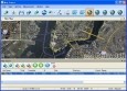
Gis Map Management
Advertisement


Lorain Water Utilities v.1.0.0.0
This is the City of Lorain's Water Utilites Work Orders Application. Water utility workers use this app in the field to perform maintence records. Features Include: - View & edit all scheduled work orders. - GIS map of Lorain's Water Utilites.
Advertisement
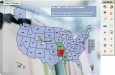
Dealer Store Locator Map (USA)
Interactive Flash Dealer Store Locator is a unique vector-based tool with the administrative mode that helps you originally represent the information about your business locations in the US in the simplest way. USA Flash Dealer Store Locator Map covers
VIEWLOG v.3.0.0059
VIEWLOG provides a truly integrated borehole data management and interpretation system.
VSM Demo v.2. 2. 1930
Visual Site Manager (VSM) is a Microsoft Acces based data-management system that provides multi-user access to environmental databases through an intuitive,map-based graphical interface.
GeoAnalyst Hydron Module v.1.0
With Hydro GeoAnalyst, you can expect the highest level of performance and a completely scalable solution to meet your groundwater project demands!
ORC CAD Standards v.4.0
Often states, provinces, cities, architectural and engineering firms receive an abundance of data, from various sources, in the form of drawings.
Wadiso v.5.06.0310
Wadiso is a comprehensive computer program for the analysis and optimal design of water distribution networks. The program originated from the WADISO public domain model developed by Prof.

Icons-Land Vista Style GIS/GPS/MAP Icon Set v.2.0
Vista Style GIS/GPS/Map Icon Set is of perfect design quality. Being represented in 7 sizes, icons can be widely used in local service applications, GPS tracking and GIS applications, and any kind of mapping applications.
Map Export v.2.7.1.0
Map Export is a GIS developer oriented tool for downloading and exporting background image. Map Export can export both satellite imagery and street maps from Google Map. It can export in many kinds of bmp format as you like.
Network Map Auto Draw v.3.60
Network Map Auto Draw is a compact network discovery and management tool for the Win32 platform : in a few minutes, it will discover all TCP/IP nodes and draw full graphical map using DNS, MAC addresses, SNMP, WMI, NetBIOS and TCP Ports information.
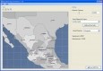
AnyChart Flash Map Converter v.1.0.4
Convert ESRI ShapeFiles (.SHP) geolocation data into AnyMap format to be used with AnyChart. AnyChart Flash Map Converter allows making use of a wide choice of maps with AnyChart, a GIS system that recognizes map data in AnyMap format only.